 Helpdesk / FAQ
 User Guides and Updates
 Free demo
 Timelapse Planner
 Order tracking
 Shipping
 Trade in offers
 Contact us
The best solution for urban infrastructure management
Why is Tikee the ideal solution for Smart Cities?
Self-sufficient and connected
6K 220° pictures

Reporting and dashboards
AI-based analyses and tools

Dedicated cloud platform
Weatherproof IP66
Book a one-to-one demo with an Enlaps expert
AI for urban environments
In the age of digital urbanization, where smart cities are taking shape thanks to the integration of advanced technologies, image analysis based on artificial intelligence (AI) is positioning itself as an invaluable tool. This innovative combination enables us to capture and decode the evolution of urban environments, while extracting valuable information for better planning and more efficient infrastructure management. This convergence of image capture and AI is redefining the way we perceive, design and manage our smart cities.

Possible applications
Possible applications
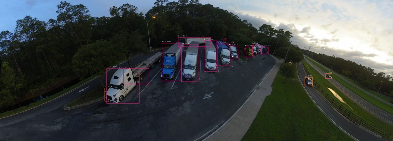
Optimizing site traffic
The integration of AI with an image capture solution creates an opportunity for relevant analysis. Thanks to the algorithms developed by Enlaps' R&D team, it is possible to analyze people and transport flows.
These analyses provide key information on :
- mobility trends
- activity peaks
- congestion zones
and enable infrastructures to be adapted and optimized accordingly.

"By analyzing this data, tourism management can be taken to the next level, enabling more precise marketing strategies and optimized resource allocation, which will improve the tourist experience."
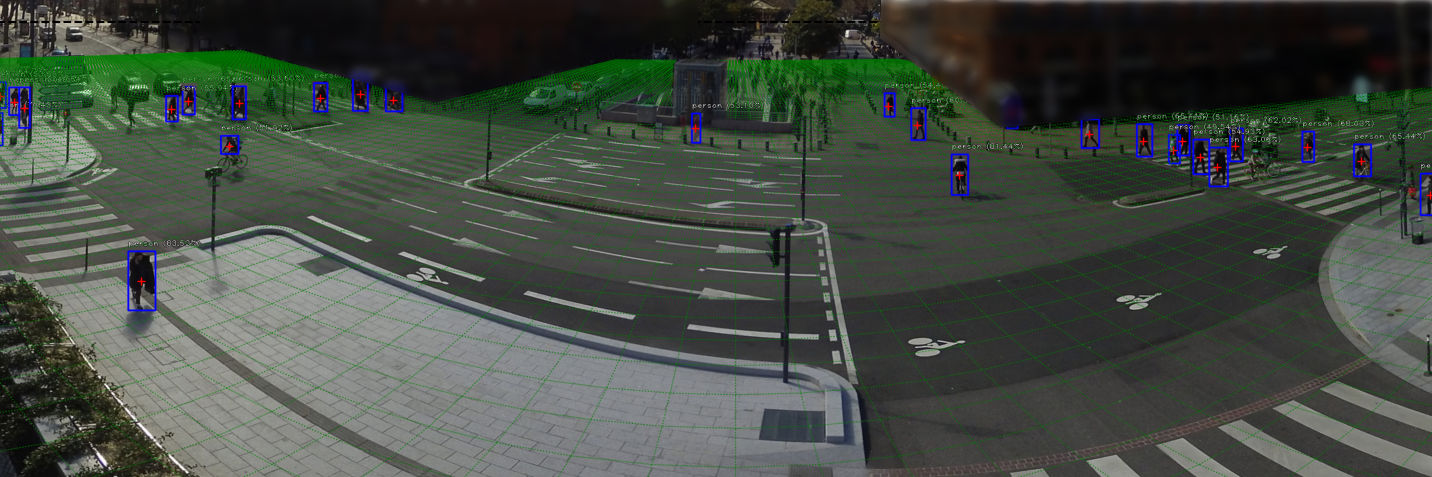
Adapting traffic flows in urban environments
Traffic patterns can be deduced from the images captured, thus facilitating decision-making in terms of :
- urban planning
- traffic light management
- public transport route optimization
The data collected can also help reduce traffic jams and improve traffic flow.

"Thanks to AI algorithms we were able to reliably and quickly assess people's movements, more efficiently than through simple counting requiring the deployment of people."
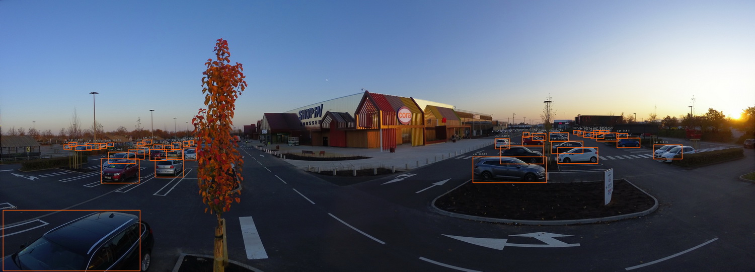
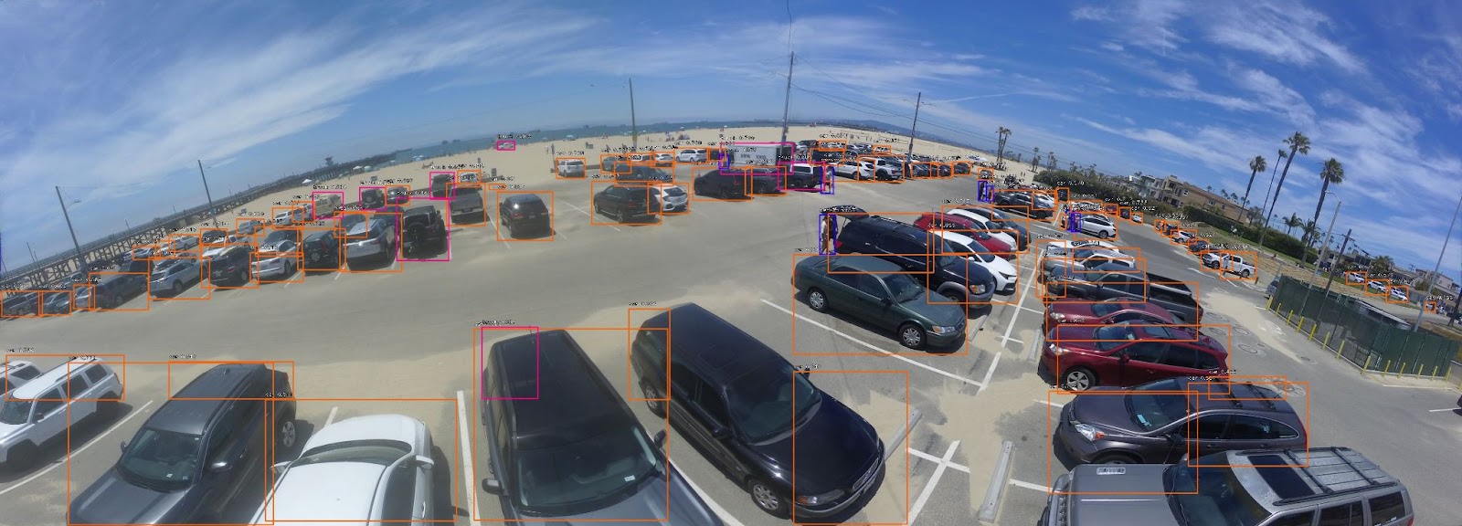
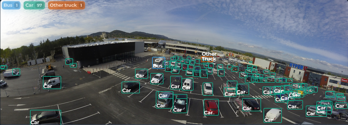
Improving parking management
Another promising use for AI in this context is the monitoring of parking spaces. Through image analysis, AI can determine the availability or occupancy of parking spaces over time, helping to reduce congestion and optimize the use of parking spaces.

"The Tikee solution proved to be less expensive than the previous one, with more reliable results, comprehensive data and less maintenance ."
myTikee Reporting :
the essentials
the essentials

IA Dashboard
Dashboards specifically generated to help professionals analyze data for optimal project tracking.
Detections
Identify and detect objects (vehicles, construction equipment) and people (and their personal protective equipment: helmet, jacket, visibility pants) on demand.
Analytics: Activity Score & Safety Score
Measure the level of activity on the construction site to optimize resources and plan deadlines.
GDPR
Select and hide GDPR-compliant areas on images, or blur people in the image.