




Change perspective

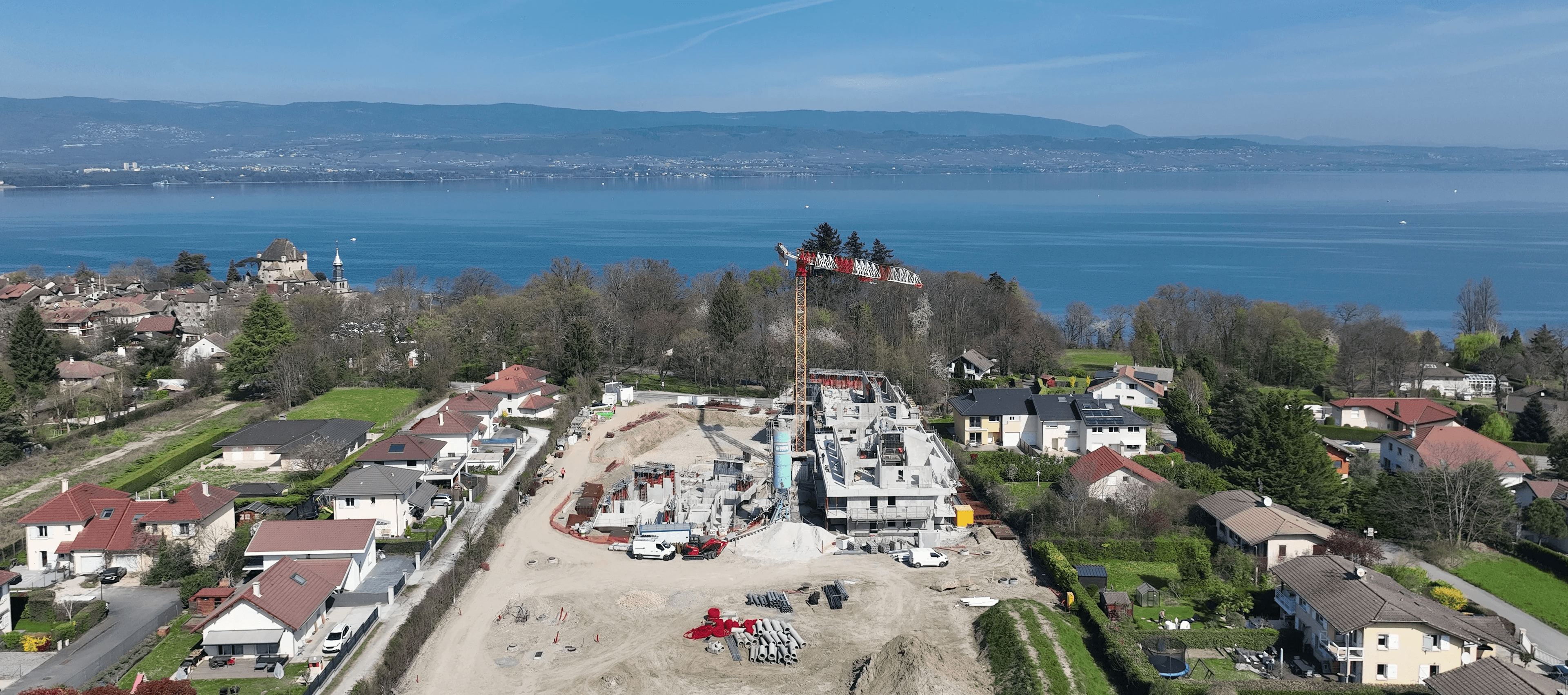
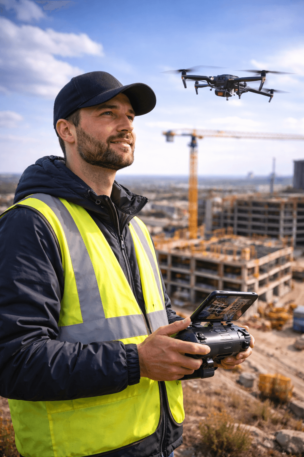
Construction drone monitoring with automated dronelapse

Change perspective

Construction drone monitoring with automated dronelapse

Change perspective

Construction drone monitoring with automated dronelapse

Create a perfectly aligned, clean, synchronized dronelapse

No complex workflows

No manual alignment

No post-production headaches

Create a perfectly aligned, clean, synchronized dronelapse

No complex workflows

No manual alignment

No post-production headaches

Create a perfectly aligned, clean, synchronized dronelapse

No complex workflows

No manual alignment

No post-production headaches

Why Dronelapse is a game changer for drone professionals

WITHOUT

WITH

Reduce post-production friction

You can spend less time editing, and focus on clients and growth

Deliver more than a one-off video

Your clients no longer wait months for value.

Create a recurring, high-value service

A service your clients can subscribe to, not a one-time request.

Why Dronelapse is a game changer for drone professionals

WITHOUT

WITH

Reduce post-production friction

You can spend less time editing, and focus on clients and growth

Deliver more than a one-off video

Your clients no longer wait months for value.

Create a recurring, high-value service

A service your clients can subscribe to, not a one-time request.

Why Dronelapse is a game changer for drone professionals

WITHOUT

WITH

Reduce post-production friction

You can spend less time editing, and focus on clients and growth

Deliver more than a one-off video

Your clients no longer wait months for value.

Create a recurring, high-value service

A service your clients can subscribe to, not a one-time request.

Introducing Dronelapse Builder, a new feature available on myTikee, that transforms multiple drone flights over the same site into perfectly aligned individual videos, and one final dronelapse video (4K MP4)

  • Reliable framing

  • Consistent perspective

  • Client-ready results

Fly smarter, more often, with fewer constraints.

Dronelapse Builder works perfectly with:

Lightweight, accessible drones

Affordable equipment

Repeatable, compliant flight paths

Introducing Dronelapse Builder, a new feature available on myTikee, that transforms multiple drone flights over the same site into perfectly aligned individual videos, and one final dronelapse video (4K MP4)

  • Reliable framing

  • Consistent perspective

  • Client-ready results

Fly smarter, more often, with fewer constraints.

Dronelapse Builder works perfectly with:

Lightweight, accessible drones

Affordable equipment

Repeatable, compliant flight paths

Introducing Dronelapse Builder, a new feature available on myTikee, that transforms multiple drone flights over the same site into perfectly aligned individual videos, and one final dronelapse video (4K MP4)

  • Reliable framing

  • Consistent perspective

  • Client-ready results

Fly smarter, more often, with fewer constraints.

Dronelapse Builder works perfectly with:

Lightweight, accessible drones

Affordable equipment

Repeatable, compliant flight paths

One ecosystem
Two perspectives
Full project visibility

Dronelapse complements timelapse cameras perfectly.

tikee cameras

Timelapse cameras

continuous,
ground-based monitoring

tikee cameras

Dronelapse

dynamic aerial perspective
at key moments

One ecosystem
Two perspectives
Full project visibility

Dronelapse complements timelapse cameras perfectly.

tikee cameras

Timelapse cameras

continuous,
ground-based monitoring

tikee cameras

Dronelapse

dynamic aerial perspective
at key moments

One ecosystem
Two perspectives
Full project visibility

Dronelapse complements timelapse cameras perfectly.

tikee cameras

Timelapse cameras

continuous,
ground-based monitoring

tikee cameras

Dronelapse

dynamic aerial perspective
at key moments

A new feature dedicated to:

video icon
video icon

Drone operators & videographers

  • Offer a premium, differentiated service

  • Deliver faster with better consistency

  • Increase margins by reducing editing time
construction icon
construction icon

Construction service providers

  • Provide visual proof of progress

  • Support reporting, audits and communication

  • Build long-term client relationships

Enlaps Preferred Partners (EPP)

  • Unlock a new Enlaps-native feature

  • Strengthen your positioning in construction monitoring

  • Access training, tools and visibility

“Huge gains on post prod time.

Way better results than manual on complex cases."

Hugo Barbier

Enlaps Preferred Partner & Dronelapse Expert

“Huge gains on post prod time.

Way better results than manual on complex cases."

Hugo Barbier

Enlaps Preferred Partner & Dronelapse Expert

“Huge gains on post prod time.

Way better results than manual on complex cases."

Hugo Barbier

Enlaps Preferred Partner & Dronelapse Expert

How it works

Simple. Repeatable. Professional.

1️⃣

Fly the same trajectory over time

2️⃣

Upload your drone videos to myTikee

3️⃣

Let Dronelapse Builder align and synchronize

4️⃣

Export final dronelapse video (4K)

How it works

Simple. Repeatable. Professional.

1️⃣

Fly the same trajectory over time

2️⃣

Upload your drone videos to myTikee

3️⃣

Let Dronelapse Builder align and synchronize

4️⃣

Export final dronelapse video (4K)

How it works

Simple. Repeatable. Professional.

1️⃣

Fly the same trajectory over time

2️⃣

Upload your drone videos to myTikee

3️⃣

Let Dronelapse Builder align and synchronize

4️⃣

Export final dronelapse video (4K)

Ready to move to

As a Dronelapse Expert, you get:

  • Access to Dronelapse Builder

  • Official Enlaps Dronelapse Expert status

  • Training & best practices

  • Sales & marketing materials

  • New revenue opportunities with construction clients

Ready to move to

As a Dronelapse Expert, you get:

  • Access to Dronelapse Builder

  • Official Enlaps Dronelapse Expert status

  • Training & best practices

  • Sales & marketing materials

  • New revenue opportunities with construction clients

FAQ

Frequently Asked Questions

What is construction drone monitoring?

Drone construction monitoring involves using an uncrewed aerial vehicle (UAV)—commonly referred to as a construction monitoring drone—to capture high-resolution imagery, video, and spatial data of a job site. This process allows project managers to track progress, verify as-built conditions against blueprints, and manage resources efficiently. Deploying a drone for construction site oversight provides stakeholders with a comprehensive, real-time bird's-eye view of the entire project without needing to be physically present.

How are drones used in construction projects?

A drone for construction serves multiple purposes throughout a project's lifecycle. During pre-construction, drone construction services are utilized to conduct aerial reconnaissance and site planning. As building begins, drone construction mapping creates accurate 2D orthomosaics and 3D models of the terrain. Additionally, teams use these aerial insights for safety audits, volumetric calculations of stockpiles, and material tracking.

What are the benefits of drone construction monitoring?

The primary benefits include enhanced safety, reduced costs, and improved data accuracy. Using a drone for construction inspection eliminates the need for workers to climb high or hazardous structures to check quality manually. Furthermore, a regular construction drone survey delivers precise, actionable data much faster than traditional ground-based surveying methods, reducing project delays and preventing costly rework by catching errors early.

What is the best drone for construction monitoring and inspections?

The "best" drone depends on the scale of your project, but leading construction drone companies typically look for reliability, battery life, and payload options. For standard site mapping, the DJI Mavic 3 Enterprise or Phantom 4 RTK are industry favorites due to their high precision. For advanced drone for construction inspection tasks—especially those requiring thermal imaging or close-up structural analysis—rugged enterprise platforms like the DJI Matrice 350 RTK are highly recommended.

Is it legal to fly drones over construction sites in Europe?

Yes, but it requires strict compliance with the European Union Aviation Safety Agency (EASA) regulations, which apply across all EU member states. Commercial drone operators must be registered with their national aviation authority and ensure their pilots hold the appropriate remote pilot certificate (such as the A2 Certificate for the Open category or specific authorizations for the Specific category). Flights must strictly abide by geographical zones and airspace restrictions. Flying over uninvolved people is generally prohibited unless specific drone classes and operational categories allow it, and explicit permission from the general contractor or property owner is required to operate a drone for construction site monitoring.

How much does construction drone monitoring cost?

The cost varies widely based on whether you choose to outsource to professional drone construction services or build an in-house drone program. Hiring external construction drone companies for a single survey or mapping flight can range from $500 to $2,500+ depending on site size and deliverables. Building an internal program requires upfront investments in hardware, pilot training, and construction drone software, but it offers a much lower cost-per-flight over multi-year projects.

What is the difference between drone monitoring and construction timelapse?

While both track progress, they serve entirely different functions:

  • Construction Timelapse: Relies on fixed, ground-based cameras that capture photos at set intervals over months to show visual evolution from a single angle.

  • Drone Monitoring: Provides dynamic, multi-dimensional aerial insights. It goes beyond simple visuals to generate measurable data, accurate site maps, and 3D models that ground cameras simply cannot replicate.

How often should drone flights be performed during a construction project?

Flight frequency depends on the pace of construction and project milestones. Many teams schedule weekly or bi-weekly flights to keep stakeholders updated and maintain an accurate digital twin. Once the data is captured, advanced drone software for construction is used to process the images. Utilizing specialized drone mapping software for construction tech allows teams to overlay aerial maps with BIM designs seamlessly, turning routine flights into a powerful project management asset.


New Camera

Limitless Capture Experience -> Learn more

English